...
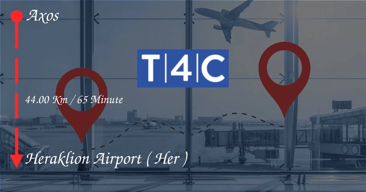
How To Go From Axos to HERAKLION AIRPORT ( HER )
Planning a trip from Axos to Heraklion Airport (HER)? This comprehensive guide outlines your transportation options for the 44km journey, taking approximately 65 minutes. We'll cover everything from cost-effective public transport to convenient private transfers, ensuring you find the best fit for your needs and budget. Discover the pros and cons of each method, helping you navigate your transfer smoothly and stress-free, allowing you to focus on enjoying your trip to or from Crete. Whether you prefer a scenic drive, a budget-friendly bus ride, or the ultimate convenience of a pre-booked taxi or private transfer, we've got you covered. Let's explore the various ways to get from Axos to Heraklion Airport efficiently and comfortably!
Getting From Axos to Heraklion Airport (HER): Your Transportation Options
The 44-kilometer journey from Axos to Heraklion Airport (HER) might seem daunting, but with several transportation options available, choosing the right one is key to a stress-free travel experience. Let's explore your choices:
1. Taxi or Private Transfer
For unparalleled convenience and comfort, a taxi or pre-booked private transfer is your best bet. A private transfer offers a door-to-door service, picking you up directly from your accommodation in Axos and dropping you off at the airport terminal. This eliminates the need to navigate public transport schedules and transfers, especially beneficial if you're traveling with heavy luggage or have time constraints. Booking in advance is highly recommended, particularly during peak seasons, to secure availability and potentially get a better rate. While pricier than public transport, the convenience and comfort often make it worth the extra expense, particularly for families or those prioritizing a hassle-free travel experience.
Pros:
- Direct door-to-door service
- Convenience and comfort
- No need to navigate public transport schedules
- Suitable for luggage and large groups
Cons:
- More expensive than public transport
- Requires pre-booking (ideally)
2. Public Bus
A more budget-friendly option is the public bus. Buses in Crete typically connect major towns and cities, though the frequency might be less frequent than in larger urban areas. You'll likely need to check bus schedules in advance and potentially make a transfer or two to reach the airport. While less expensive, it involves more planning and waiting time. Be prepared for potentially longer travel times due to stops along the route and potential delays.
Pros:
- Cost-effective
- Environmentally friendly
Cons:
- Less frequent service
- Potentially longer travel times
- May require transfers
- Less comfortable than a private transfer
3. Rental Car
Renting a car offers flexibility, allowing you to explore Crete at your own pace before or after your flight. However, parking at Heraklion Airport can be costly, and you'll need to factor in the cost of rental, fuel, and parking. Driving in Crete can also be challenging for those unfamiliar with the roads, especially if driving in mountainous areas to get to Axos initially. Consider the overall cost and your driving comfort level before opting for this method.
Pros:
- Flexibility and independence
- Explore Crete at your own pace
Cons:
- Additional costs (rental, fuel, parking)
- Can be challenging to drive in Crete
- Parking fees at the airport
Choosing the Best Option for You
The ideal transportation method depends on your priorities. If convenience and comfort are paramount, a private transfer is the way to go. For budget travelers, the public bus is the most economical option, though it requires more time and planning. A rental car offers freedom but involves additional costs and potential driving challenges. Carefully weigh the pros and cons of each option to make the best decision for your trip from Axos to Heraklion Airport (HER).
Remember to check schedules and book in advance, especially during peak tourist seasons, to ensure a smooth and stress-free transfer.